Ashland Daily Photo
Ashland Daily Photo - A picture a day from beautiful Ashland, Southern Oregon USA in the Rogue Valley
The above will search Ashland Daily Photo.


Posts tagged biking

White Rabbit

ashland oregon mad hatter queen of hearts

My first time down White Rabbit was New Year’s Day in 2001. The weather was warm, and I was a rather unexperienced mountain biker at the time. This trail is not for the beginner. There are some serious drops in a few places that aren’t even easy when you walk the trail. The names of the side trails are all Alice in Wonderland themed. For a map and directions see my prior post.

A seat with a view

white rabbit trail ashland oregon

I took today’s photo last week on White Rabbit Trail, less than half a mile from Park Street.

City of Ashland – Creek to Crest Trail Route (map)

siskiyou mountain range

There are many paths to pick from when you get outside of Ashland’s main streets. I like to try a different one each time. It can get a little crazy if you are pressed for time or don’t want to get lost so take this along if that is your situation. Click on the image for a much larger and detailed version (which you can print) of this free map of places to hike, bike, and run in the mountains around Ashland. Keep heading south (from Four Corners) if you want to go to the top of Mt. Ashland.

Rim Drive

biking crater lake national park rim road

Rim Drive around Crater Lake offers many majestic views. Although the road is paved, it isn’t an easy ride. There can be lots of cars (avoid weekends and holidays), and there isn’t a flat section to be found. As a rider you’ll do lots of climbing.

Today’s photo of Ryan is of one of those brief downhill moments.

Crater Lake from the east shore

southern oregon red cone

The skies were gray all day long, but they cleared a bit near the end of the day when I took this photo of Crater Lake from near Sentinel Rock. Unfortunately, my memory of this location is not a good one as our bikes had just been stolen. How can bikes you are riding get stolen you ask?

As mentioned before the day had its low points. The ride was about twice as long as anticipated and after 20 miles my legs began to cramp. A few miles later we hitched a ride and hid our bikes off the road with the intention of getting a ride to our car, driving our car back, and picking up the bikes. All went as planned until we got back and found the bikes missing. A dishonest someone must have seen us hiding the bikes. 🙁

The only silver lining is that my bike was in need of an overhaul anyway, and Ryan is getting too tall for his.

Crater Lake week

bike rim

Ryan and I went for a bike ride around Crater Lake this past Saturday. It was a day filled with many highs and many lows. I’ll share some of those, and some photos, over the coming week.

The first “low” was that the road is much longer than I anticipated. A friend told me it takes 2.5 hours on a bike, but we did not find that to be the case. Crater Lake is about 5 miles across. Using the old equation of πr2 (pie r squared) yields a circumference much smaller than the road that goes around the crater, which we found out after the fact is 36 miles in length. You are not actually on the rim of the crater for very long or in many places on the “Rim Road.” Usually you are on the outside of the rim, with just occasional glimpses of the beauty of the lake.

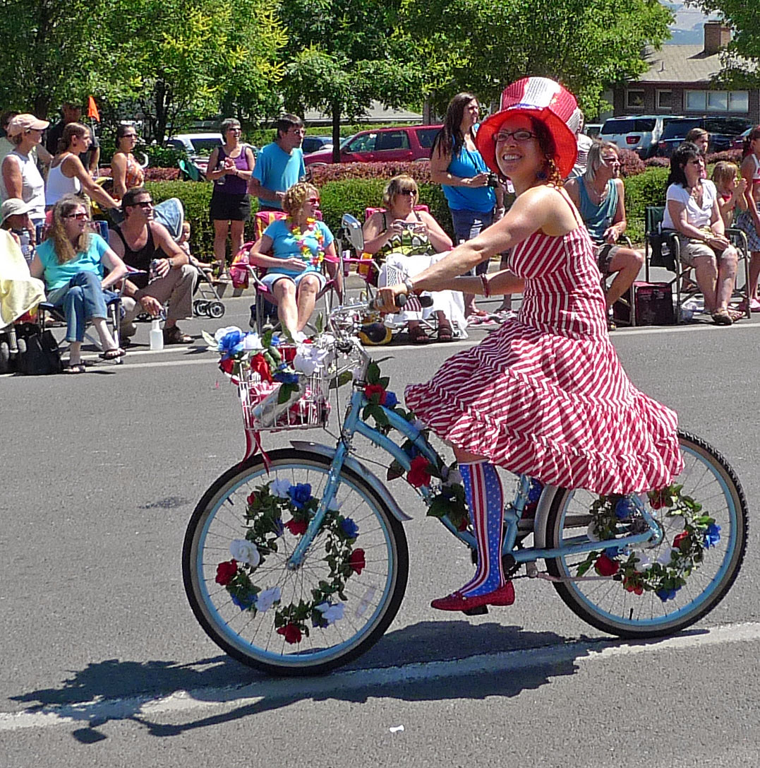
Fourth of July biker girl

ashland bike girl

This lady is seemingly always on her bike. I see her around town nearly daily, all year long. She doesn’t wait for a holiday to decorate her bike either. A day like the 4th of July is her day to shine in the parade, doing what she does best.

Bull Gap Trail

Today’s picture goes along with yesterday’s. It was taken a couple of months after yesterday’s photo in 2004. My kids and I were hiking on Bull Gap Trail. In the background (upper left) you can see Wagner Butte.

Bull Gap is a trail that leads you right up to the ski lodge on Mt. Ashland. I’ve hiked it a couple of times and ridden my bike down it a half dozen or so times. If you want to bike down it you should ride your bike up the main road to the lodge or you can ride up some fire roads to get there. If you start from Ashland you’ll be in for a long day. If you don’t have the time you can drive a car up to four corners and ride up from there.

Both Bull Gap and Wagner Butte are in the Siskiyou Mountains. From both you can view the Cascade Mountain Range.

Applegate Lake

Photo taken in August 2007

To the west of Ashland lies Applegate Lake (sometimes referred to as Applegate Reservoir). There are some good biking and hiking trails around the lake.

Near Fish Lake

Photo taken in July of 2007

The above picture is from a spot near Fish Lake, just east of Ashland, in the Oregon Cascade Mountains. There was a nice little trail that we road our bikes on, but you could also hike it if you wanted to. We didn’t see anyone else until we got to the resort area of Fish Lake.