Ashland Daily Photo
Ashland Daily Photo - A picture a day from beautiful Ashland, Southern Oregon USA in the Rogue Valley
The above will search Ashland Daily Photo.


Posts tagged hike

Snowshoeing to Grizzly Peak

Shale City Road snow grizzly peak ski poles

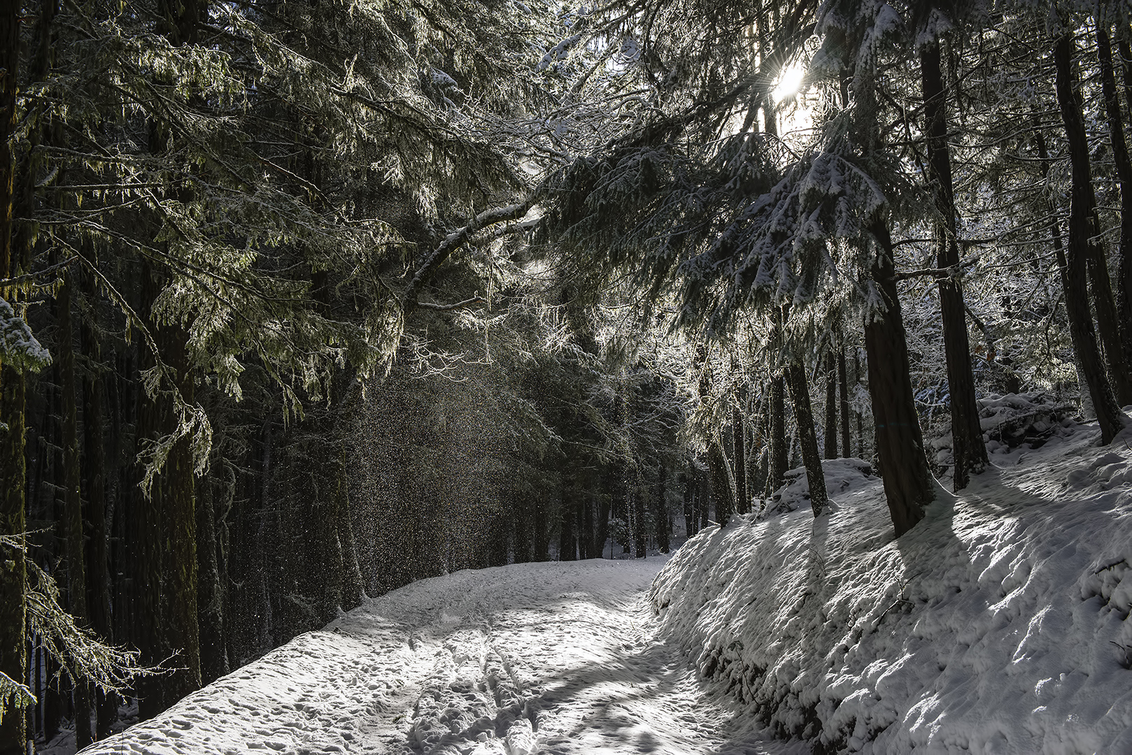
This past weekend, after feeling great after an hour-long workout at the Ashland YMCA, I decided to snowshoe up the backside of Grizzly Peak. Normally you can drive to the Grizzly Peak trail head but not this time of year. While there is no snow currently on the Ashland side of Grizzly Peak, there is plenty of snow on the other side.

I parked on Shale City Road near road number 38-2E-9.2. From there the snow was several feet deep so I had no choice but to start. I took today’s photo near that location. A mile later and there were no more human tracks in the snow. From the three-way junction it was just me on the snow, which felt great (like I was Ernest Shackleton or something) but at the same time it was a little scary. There were lots of animal tracks, and it was a Sunday afternoon so I figured it would be next weekend, at the earliest, before anyone found my carcass should I break a leg or should an animal decide I needed to be taken out.

On top of this, fatigue started to set in so I turned around once I got to the parking lot rather than go another 2+ miles to the top of Grizzly Peak. Next time I won’t do a workout before heading for the top, and I should be able to manage the nine-mile, round-trip hike. Nine miles in snow shoes, when you are sinking several inches with each step and gaining elevation half the time as well, is not nearly as easy as walking around town for nine miles.

Table Rock Sunset

table rock sunset medford oregon white city gold hill central point

Table Rock – Southern Oregon

A lovely hike, especially at sunset, Upper Table Rock, a bit north of Medford (nearer to White City and Central Point actually) was the location for today’s photo back in the summer of 2012.

Buck Prairie Nordic Trails

buck prairie snow panorama shoeing skiing x-country ashland cross country skiing

180 degree panorama of Buck Prairie Nordic Trail in the snow

I headed up Dead Indian Memorial Road to Buck Prairie yesterday. The clouds were thick, but for a few minutes on the trail, there was a bit of blue when I took today’s photo. This panorama is actually 9 vertical pictures stitched together into a horizontal landscape. I was trying out my new snowshoes, but most people out yesterday were on cross country skis as you can see from the tracks in the snow.

Sun and snow can mix well

ashland oregon hiking snow shoes cross country x skiing trail

We drove up to the White Rabbit trailhead parking lot a couple days ago to hike to the end of the Lamb Mine Cave off of Ashland Loop Road. There was lots of snow and I was wishing I had brought along my snow shoes that I received for Christmas. The sun came out at times and, with it, large quantities of snow fell from the trees making a lovely, winter landscape.

Descending from Castle Peak

heart lake castle crags hiking

During our only full day at Lake Siskiyou we drove about 8 miles to Castle Lake (elevation 5436 feet). From there we went on a 5-mile (or so) hike to Heart Lake (elevation 6035 feet) and then above it to Castle Peak (elevation 6617 feet). The views are best from Heart Lake and above Heart Lake on Castle Peak where you can see the lakes, Mt. Shasta, Castle Crags and a lovely 360 degrees of wilderness. Today’s photo isn’t from the top though. The lakes are obscured by trees, but you can see Black Butte and Mt. Shasta, as well as some of my hiking party.

Table Rock sunset hike

upper table rock southern oregon ashland medford hiking tips easy kids family

Last month we hiked up Upper Table Rock to watch the sun set. It’s not much of a hike really–more like a good walk. I’m not sure the exact distance we walked, but I doubt it was more than 5 miles including exploring the top. There is a bit of elevation gain on the way up, but it isn’t strenuous. In the summer you probably don’t want to do it in the afternoon or it will feel difficult from the heat. Go up in the morning or just before the sunset (with a flashlight for the way down) if you decide to visit on a hot day. Bring water.

Directions: To get to the Upper Table Rock trailhead from I-5 take the Central Point Exit 33 (just north of Medford and about 20 minutes north of Ashland), drive east on Biddle Road 1 mile, turn left on Table Rock Road for 5.2 miles to a curve, and then turn right on Modoc Road for 1.5 miles to the trailhead parking lot on the left. There is a sign as you approach Modoc Road so it is hard to miss.

Brown Mountain Trail

pacific crest trail brown mountain oregon

I walked on this trail late last summer for several hours and didn’t encounter a single person. It was wonderful.

Eastview Trail – Ashland, Oregon

eastview trail ashland oregon mountain biking hiking southern rogue valley

The guidebooks for hiking or biking Eastview Trail talk about the wonderful views from the trail itself. Actually, there aren’t any views of the east anymore from Eastview Trail as the trees have grown since the trail was created and now the views are all obstructed. It’s still a nice trail though.

Near the trailhead, you do get a bit of a view from the location pictured here. That’s Mount McLoughlin poking up in the distance on the right.

A stroll through the Trinity Alps

trinity alps northern california hiking trails

Today’s photo is from the archives, July of 2009 to be exact. Without a person or two in this photo you don’t get the sense of just how tall these trees were in Northern California.

Near Brown Mountain

southern oregon forest near brown mountain lake of the woods

Forest between "Lake of the Woods" and Brown Mountain - Southern Oregon

Today’s photo is from late summer of last year when I did the Brown Mountain Trail–a trail which doesn’t actually go up Brown Mountain at all.