Ashland Daily Photo
Ashland Daily Photo - A picture a day from beautiful Ashland, Southern Oregon USA in the Rogue Valley
The above will search Ashland Daily Photo.


Posts tagged hike

Pilot Rock from Soda Mountain

pilot rock soda mountain

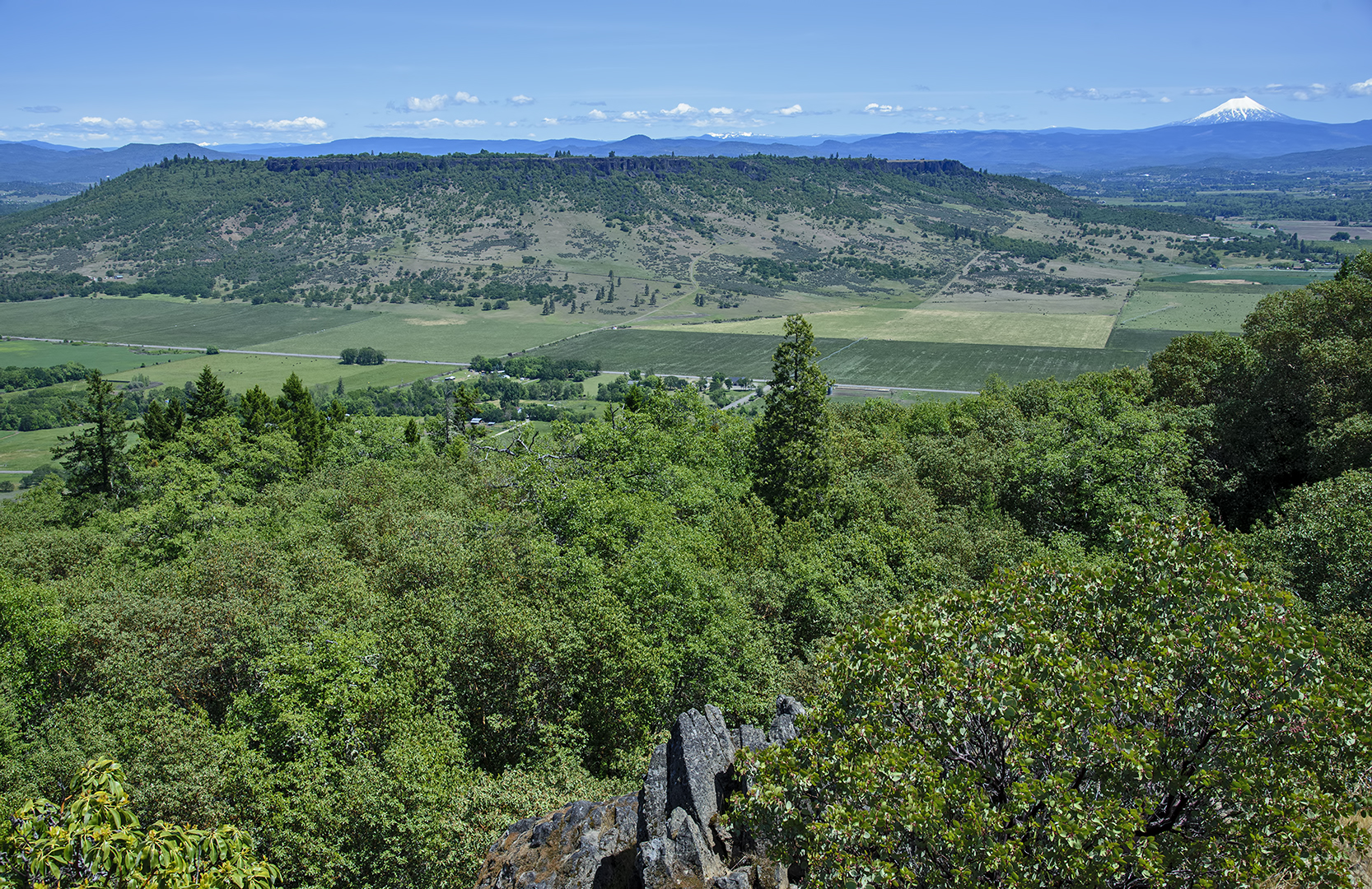
Pilot Rock from Soda Mountain

Today’s photo shows a different side of Pilot Rock. The view of Pilot Rock from Ashland or I-5 heading north from California are the more common vantage points. Today’s photo is from the east. We hiked a few miles from the Hobart Peak trail head on Soda Mountain Road to the Soda Mountain lookout last month. There is also a 9-mile trail on the Pacific Crest Trail (PCT) from near this location to Pilot Rock.

Castle Crags

hiking castle crags

hiking Castle Crags

Today’s photo is from nearly two years ago. We weren’t really hiking Castle Crags (in the background to the right), but the views of Castle Crags from this location were fantastic. For more on how to get to today’s photo spot see this prior post.

Hiking lens

lower table rock lizard

Lower Table Rock lizard

Whenever I go for a hike I face the dilemma of whether or not to bring my camera and if I bring it which lens. Sometimes I just attach a prime 24mm lens to minimize weight and size. But if I had gone that route when we did Lower Table Rock a couple weeks ago I would have missed out on this shot. My 24-120mm comes in very handy in such situations.

Upper Table Rock from Lower Table Rock

upper table rock mt mcloughlin

Upper Table Rock and Mt. McLoughlin

We took a little hike for Mother’s Day yesterday. While I’ve done the Upper Table Rock hike a half dozen times or so over the 14 years I’ve lived in the Rogue Valley, this was my first time going up Lower Table Rock.

Hobart Peak

Ellie Ryan Hobart Peak southern oregon pct hiking pacific crest trail ashland oregon

Ellie & Ryan on Hobart Peak looking north toward Emigrant Lake and Ashland

After living in Ashland for nearly 14 years, I thought I had been on every nearby hike. Turns out I was wrong. Hobart Peak (AKA Hobart Bluff) is more of a walk than a hike as it isn’t long (about 3 miles round trip) and only has a bit of elevation gain near the end. The sky was completely blue on the day we went. I want to go again for a sunrise or sunset or between storms.

If you are in Ashland and want to check it out, get on Highway 66 toward the Green Springs. After a little less than 15 miles from Oak Tree Northwest Bar & Grill, turn right onto Soda Mountain Road. In about 3.5 miles park at the trail marker near a meadow. You’ll be on the Pacific Crest Trail (PCT) initially. A sign a mile in will direct you to the left to get to the location in today’s photo.

Strange winter scene on Grizzly Peak

grizzly peak southern oregon

View from Grizzly Peak during minimal snow winter

I have yet to break out my snow shoes this winter. Last weekend we hiked to the top of Grizzly Peak where I took this photo from. Last year at this time this was the scene miles below the location of today’s photo.

This year we were able to drive all the way to the parking lot which is pretty much unheard of in January or February. From there the trail usually has several feet of snow on it in winter as it is in the shade and doesn’t melt until May or so. Not this year.

PCT near Brown Mountain

pct trail hike near brown mountain

Pacific Crest Trail near Brown Mountain in Southern Oregon

The Pacific Crest Trail is poised to become super famous thanks to the Reese Witherspoon movie (Wild) coming out this year. Today’s photo is a little piece of the Southern Oregon portion from a few summers ago.

White Rabbit Trail

view while walking along White Rabbit Trail in the Ashland watershed

view while walking along White Rabbit Trail in the Ashland watershed

Hiking in Oregon

eugene skinner butte trail

Skinner Butte Trail
Eugene, Oregon

I just got back from four days spent north of Ashland on or near I-5 (mostly in Tacoma, Seattle, and Portland). Today’s photo is from a trip earlier this year though.

View from Yosemite’s Mist Trail

yosemite falls from mist trail

Upper Yosemite Falls from Mist Trail

On my other blog, I’ll be posting a dozen photos or so from our spring break trip to Yosemite earlier this week. Today’s photo is from early on in the Mist Trail, perhaps our favorite of the several trails we walked.