I once again set off for another suggested walk in Day Walks Near Tokyo. Initially, I was going to try the Mt. Futago hike, but after reading stories on the internet about people getting lost and parts of the referenced trail no longer being there, I decided to go with hiking course #7, instead, Omote Tanzawa Forest.
Like my previous walks in Day Walks Near Tokyo, this one is out of date and will leave you quite frustrated and lost if you attempt to follow the author’s directions. Rather than correct all of the book’s mistakes, I’ll just tell you what I did.
From Shibusawa station (渋沢駅) take the number 2 bus from bus stop #2 for Ookura (大倉 or Okura). Many buses go to Ookura Iriguchi (大倉入口). Do not take these as Okura Iriguchi is a different place. Make sure to get on the bus marked 2. Bus #2 runs about twice an hour (the other buses run more frequently) from about 7 in the morning until about 9 at night. The bus takes about 15 minutes and costs 200 yen each way. You can purchase food and/or drink at the Okura Bus Stop on the other end. This will be your last chance at grabbing food or water so make sure you have enough.
From this location the round trip course took me five hours. I ate lunch and took almost 200 photos. You can probably do it in four and a half hours if you don’t rest much. Total time from Shinjuku back to Shinjuku (on express trains) was about nine hours.

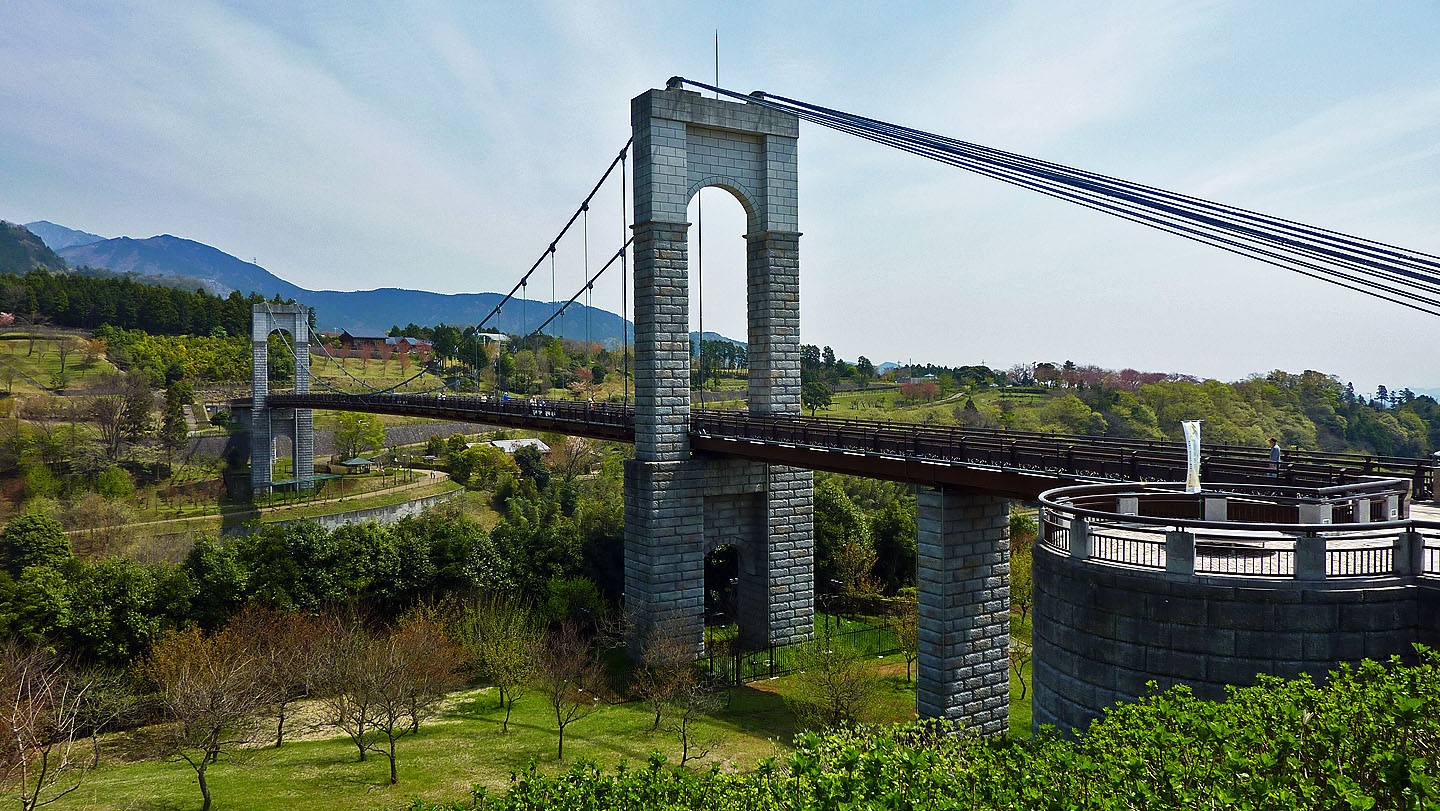
At the Okura Bus Stop you will find a park and a bridge. Both look new. I believe the bridge, pictured above, is called Kaze no Tsuribashi (風の吊り橋). If you have time you may want to explore this area before or after the rest of your hiking. I noticed a large field of tulips just a couple minutes down the hill from this location, but it was too late to explore as I was already on the moving bus heading back to Shibusawa Station at the end of the day.
From here you want to cross the street and follow the signs to Kenmin no Mori (県民の森). You’ll be walking away from the bridge and river, not along it. Others, who were on my bus, walked along the street that runs parallel to the river. I have no idea where they were going–a different course in any event.
You’ll walk by several fields and a dozen or so homes along a sometimes curvy road for about 10 minutes. Make a left at the sign and follow that road and any signs in the opposite direction as the ones pointing to Okura (大倉). You may have to go around a fence blocking part of the trail. Follow signs towards 表丹沢県民の森.

On your left you will pass the above sign. I can understand people calling a place a quasi-national park, but to put Quasi on the sign seemed a bit funny to me.
You’ll hear a river down to you left after passing this sign. Keep going for about a half hour until you see another sign with a map on it. At the map go down the steps to the right. There is a sign that probably says 黒龍の滝 or 黒竜の滝 on it pointing down. Follow it.

The trail splits a bit at the bottom. Follow it to the left for the above view of the Kokuryu Falls. I ate my lunch next to the waterfall. No one else was there. In fact, I only saw about 10 other hikers the entire day. This is very different than what you will experience on, say, Mt. Takao. Realize that there are tens of millions of people within an hour and half of this location and you’ll more fully appreciate what seeing only 10 people in 5 hours while moving outdoors can be like. This was on a Monday. If you go on a Saturday, or worse yet a Sunday, you’ll likely encounter more hikers.

Turn around at the waterfall and this is your view. Walk in this direction.

Cross a bridge over the above river for the above scene. You’ll have a hard time believing you were in Tokyo just a couple hours before. I felt like I was back home in Oregon.

You’ll see this map three or four times, at least, during the day. I took a picture of the map so I could always refer to it should I get lost. You’ll also see signs pointing you in different directions at most trail junctions. From this part of your journey (the red spot on the map marked 現在地 next to a car parking lot) always follow the paths which point to Kunugiyama (櫟山).
From the waterfall (the circled kanji in the bottom center of the above photo) you are basically doing a big clockwise loop. 櫟山 is circled on top. According to the map it is a little over an hour from the waterfall to the top of Kunugiyama. If you aren’t in decent shape, and need to rest frequently, it will take longer. You will gain hundreds of meters in elevation as you climb.

This is the toughest part of the hike. It is all uphill. However, the views are sometimes good and the trail is generally very good. For much of the time you are walking up “stairs” in the forest.

If you see this sign, a smile will cross your face as you will think your climbing is done for the day. Yeah! I made it up to the top of Mt. Kunugi, 810 meters! The views are beautiful. I can see the ocean! It’s all downhill from here, right? It has to be; I’m at the top of a mountain, right? You should then follow the sign to the right for 鍋割山方面 栗ノ木洞. At first you’ll walk down a bit. Then it is more up, up, and up. At this point I pulled up the above map on my camera. It turns out that 栗ノ木洞 (which is some kind of cave according the kanji) is actually 98 meters higher than the top of Mount Kunugi. What?!?! I always pictured mountain tops being up and caves being down. Not so here. My body wasn’t mentally prepared for this last 98 meter climb.

But I made it. This is the sign at the cave (an invisible cave apparently as I never saw it). At this point I followed the direction for 大倉方面. This trail split and then disappeared altogether. I sort of stuck to the left. Once there was no more trail I drifted to the left until I ended up on the trail for 鍋割山. I would recommend just going with the 鍋割山 trail to begin with. The views are fantastic. You don’t need to go all the way to 鍋割山 (another mountain top). After a while the trail will split with the left fork pointing to 鍋割山 and the right fork pointing to 大倉. At this point I took the 大倉 trail and had no further problems. The forest was frequently surreal. The views were often fabulous, and there are many small streams to cross and waterfalls to view on the last hour or so before you end up where you began.
I’ll post some more photos later. Today’s entry is to give you directions more than anything else.
Posted on April 21st, 2010 under Japan. Tags: hiking, signs, waterfalls. Comments: 1