TravelJapanBlog.com - Japan (07, 09-10, 13), Denmark (08, 11, 16-19, 21, 24), Korea (13), Poland (21), Mexico (14, 15, 19, 26), Iceland (17, 19), Hawaii (14, 17, 22), Czech Republic (16, 17, 19, 21)
The above will search Traveljapanblog.com.
Concerts - Landscapes - Sports


Posts tagged Mount Mudeung National Park

Gwangju nature

river near jeungsimsa

Stream near Jeungsimsa (증심사)

Along the side of Juengsimsa and the Uijae Museum of Korean Art (의재미술관) runs a lovely, small river near the edge of Mudeungsan National Park. I was too tired to check out the museum, but I hope to go back before my time in Gwangju is over.

Turtles and Korean temples

temple korean near mudeungsan

Korean temple near Mt. Mudeung

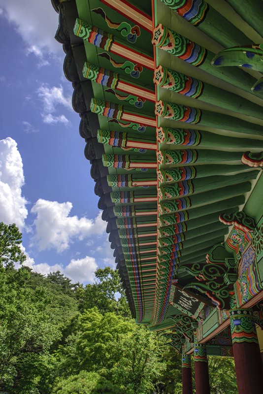
This temple was locked up by the time I was finishing my hike on Mudeungsan. The location is on the Gwangju side of Jeungsimsa Temple (증심사), just inside Mudeungsan National Park.

Hike up and over Mudeungsan and then back into Gwangju

photomerge panorama gwangju mount muduengsan

Panorama of Gwangju from the side of Mudeungsan

I did the “six hour” hike on Mt. Mudeung (무등산) a couple days ago. Today’s photo is from about an hour in. Believe it or not, after taking this photo I made it to the top of the mountain and then all the way back down into the city pictured below where I took the Gwangju Subway for the first time to get back to my bike. The hike actually took me about eight hours, but I took lots of photos along the way and got slightly lost once as well. Note if you ever plan to do this hike (especially in summer when it’s in the 80s or 90s and humid) that you can fill up your water bottles at Jangbuljae Pass. My guidebook (2010 edition of Lonely Planet Korea) says restaurant shacks can be found along the way, but they have all been cleared out since this became a National Park. In other words, bring your own food. Also note that if you ask the ranger at Jangbuljae how much farther it is to the Hakdong-Jeungsimsa Subway Station (학동·증심사입구역) and he tells you two hours, don’t believe him. Even on fresh, running legs I couldn’t have made it that far in two hours. As it was, my legs were already spent, and the last few hours were rather difficult even though it was all downhill.

Mudeungsan National Park (무등산국립공원) Hiking – so many choices…

mudeungsan national park guidemap map mountain mount signs

Signs in Mudeungsan National Park pointing hikers in various directions

My first time on Mount Mudeung was confusing, to say the least. I didn’t have a plan, and there were so many trails, taking me who knows where, that I knew I needed to come back with a better plan. Near the bus stop where Bus 1187 drops you off, you will see the above fork in the road. The trails are pretty well marked but for some of them they are only marked in Korean.

The map below can be viewed in much more detail if you click on the image. This large map with hiking trails and key locations clearly listed in Korean and English can be viewed near the bus stop as well.

mudeungsan national park guidemap map mountain

Large map of hiking trails on and around Mount Mudeung (Gwangju, South Korea)

My plan for next time is to begin at Wonhyo-sa, climb up to Seoseokdae and Ipseokdae, pass Jeungsimsa (증심사) and Uijae (Art Museum), and then walk to the Hakdong-Jeungsimsa subway station (학동·증심사입구역). Supposedly this takes about six hours.

Note that guidebooks usually refer to Mount Mudeung as Mudeungsan Provincial Park, but the name was changed to Mudeungsan National Park in 2013.

Chungjangsa Shrine (충장사) in Mount Mudeung National Park

Chungjangsa Shrine gwangju south korea 무등산국립공원

Chungjangsa Shrine (충장사)

I had a day with no plans in Gwangju, and the weather forecast was for “clear” (for once). I wanted to check out the nearby national park. My guidebook said to get on Bus 1187 at the bus terminal. I had never been to the bus terminal before, and my map was pretty bad. I finally gave up trying to get there by bike, parked, and walked over the train tracks via a foot bridge. On the other side I realized I wasn’t going to find the bus terminal easily, it was hot, and I was frustrated so I caught a cab. I told the cab driver I wanted to go to Mt. Mudeung. He made it sound like that wasn’t possible. I’m not sure if he thought I meant I wanted him to actually take me to top or if he just didn’t want to go there because it was morning and he would have to come back down with an empty cab. In any event, I assumed the former and tried to explain that I wanted him to take me to where the buses drop people off. He understood bus, and proceeded to take me to a bus stop. Oh well. At least I could now take a bus into the park.

Bus 1187 (fare only 1200 Won or about $1), it turns out, stops all over the place including the Gwangju Train Station, a place I could have easily found had I known it stopped there.

The park was incredible–like entering another world. I hiked around for four hours or so before ending up at Chungjansa, pictured here. This isn’t one of the more famous shrines or temples in the park, but it was pretty darn cool since the weather was fantastic and I had the place to myself.

Next time I’ll take a different route. You can easily head into Mt. Mudeung National Park (무등산국립공원) numerous times and never hike the same trail twice.