Cole Irvin of the Oregon Ducks Baseball Team

Oregon Ducks Baseball – Cole Irvin
I’ll be posting a bunch of photos from yesterday’s University of Oregon vs. Oregon State University baseball game here.
|
The above will search Traveljapanblog.com. Concerts - Landscapes - Sports |
Oregon Ducks Baseball – Cole Irvin
I’ll be posting a bunch of photos from yesterday’s University of Oregon vs. Oregon State University baseball game here.

Hayward Field – Eugene, Oregon – UofO track panorama
One of the most famous tracks in the world, Hayward Field doesn’t look its age (built in 1919) due to a renovation in 2004. The weather on the day I took this photo (last week) was typical for this part of Oregon–cloudy with occasional drizzle.

Oregon Duck Mascot “Puddles”
One of the more popular blog entries on this site is the one of the Oregon Duck Cheerleaders. I wonder why? In any event, the only timeless cheerleader for the Ducks is this one. Game time is almost upon us so I better post this and then find a TV.
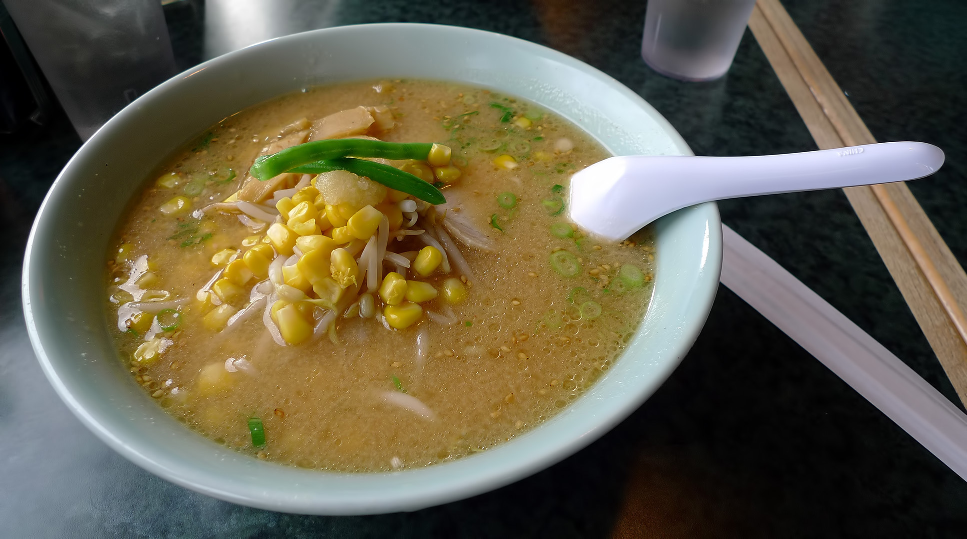
Another photo today that could have been taken in Japan but wasn’t. The place was Toshi’s Ramen in Eugene, Oregon. I may head up I-5 to a Duck’s game soon and will have to stop in for some ramen while I’m there.

The day that I had been anticipating for well over a year (returning to live in Japan for a year) finally arrived. It seemed as though it was always just a dream and something would prevent it from ever actually occurring, but somehow this day did come about. Needless to say, I didn’t need an alarm clock. I was up well before dawn due to excitement. After a shower, some more cleaning of my already clean, empty house, and other time passing activities the sun finally rose.
The above picture is of that last sunrise (for a year anyway) over Ashland, Oregon.
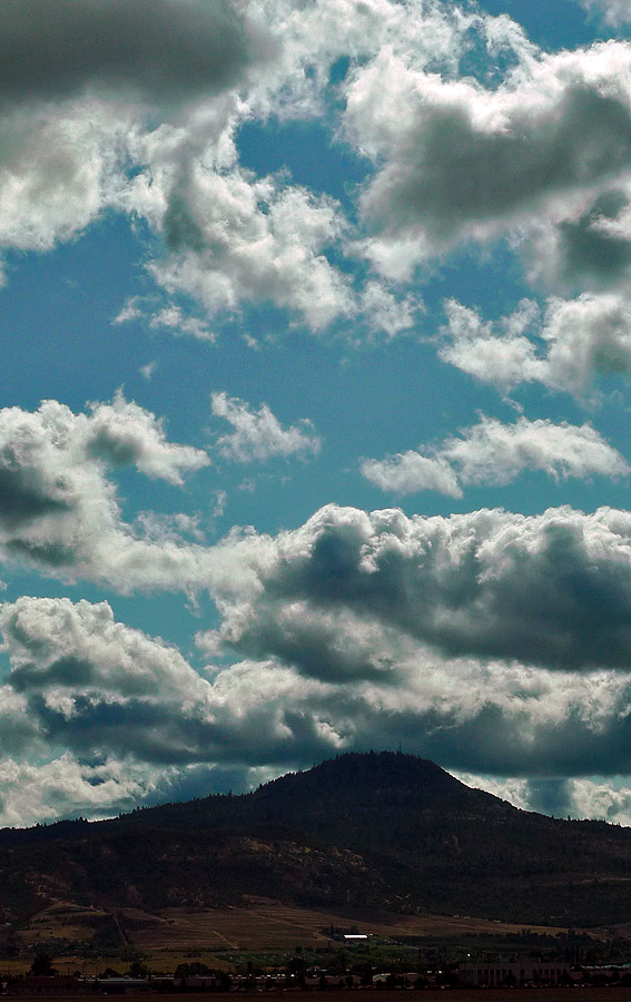
It was a beautiful morning in both Ashland and Medford, where our first plane was to depart from. The clouds were in fine form.
The above photo is from the “new” Medford airport which is a major upgrade over the old one. The former airport terminal is completely gone now. We had breakfast in the only restaurant past the security check point in the place, and this was the view. The old airport didn’t have any place to eat once you got past security which was not a good thing. I found that out on 9/11/01 when I was boarding a plane on that fateful morning. Needless to say, that plane wasn’t permitted to fly and many of us were stranded in the old airport.

My kids were as excited as I was. They’ve grown a lot since last year.
The fourth picture down on the preceding blog entry link reminded me of something about my daughter’s stuffed animal flight companion. She packed her “stuffy” in her backpack on this trip too. Her raccoon stuffed animal had a hard time making it through security. Security required her to take it out of the bag and then sent it through the x-ray machine again as if it was loaded with drugs or a weapon or something. We all had a good laugh over the treatment this piece of fluff received.

The scene from the air was no less stunning. I had a window seat on this flight. No such luck on the flight from SFO to NRT (Narita). The river you see is the Rogue River and the bluff is Table Rock. I’ll show you more photographs from the air tomorrow.
As I write this, the last riders in today’s 12Mile SuperD are crossing the finish line near my house. Although not an easy race, it doesn’t match the Revenge of the Siskiyous races that used to take place here. Those races required some serious uphill climbs as well as the downhills. Today’s race only climbs 600 feet (while dropping more than 5,000).
On Friday, I rode my mountain bike along a good section of the route. I climbed about 1,500 feet before dropping the same 1,500 feet back to my house. On the way, I rode on Toothpick (out and back) and Caterpillar (downhill only).

The Siskiyou Mountains above Ashland offer up some of the finest single track in the country. Besides Toothpick and Caterpillar trails, you can choose from dozens of other trails like White Rabbit, Catwalk (from Four Corners), Bull Gap, BTI, etc. Most aren’t for the faint of heart and take some getting used to. Toothpick isn’t very difficult, although, as the name suggests, it is sometimes not very wide. One side of the trail falls off steeply down the mountain. I wouldn’t want to crash on Toothpick because if you left the trail it would be a long way down.
On Friday the trails seemed unusually crowded. Crowded is a relative term however. We saw about 10 other people in our two hours up there. We also saw about 10 dogs. I’m not a fan of dogs–especially when I’m on a bike. I’m sure the hikers with the dogs probably aren’t too happy to see bikers either.
I once road the entire Ashland Loop Road (28 miles including 3,000 feet up and 3,000 feet down) without seeing another human being. I did see a bear on that ride though.
Next winter, after a fresh snow, I’ll have to take a ride up there with my camera. I’ve done it before without a camera and it was amazing. For now, I’ll just have to leave you with a single photo.

This is taken from approximately the center of this map between the bottom of Bull Gap and the top of Mt. Ashland. I’m on the other side of the mountain as Bull Gap though. (You can’t see Mt. Shasta from Bull Gap although you do have good views of Wagner Butte at times.) Mt. Shasta is in the background.