Ashland Daily Photo
Ashland Daily Photo - A picture a day from beautiful Ashland, Southern Oregon USA in the Rogue Valley
The above will search Ashland Daily Photo.


Archive for nature

Ashland’s Red Queen Trail

samsung s7 edge red queen ashland trail

Red Queen Trail (approaching the intersection with Road 2060, AKA Ashland Loop Road)

There’s a new trail in town. The Red Queen has been built over the past few weeks and is now open and ready for foot traffic. The trail runs from a couple intersections with Bandersnatch or Jub Jub up to the intersection of Caterpillar crossing the Ashland Loop Road. There aren’t any significant view or overlook areas, but it is a nice trail in the watershed without any bikes.

One way to get there is to park near the water tank where Terrace and Ashland Loop intersect. Just past the water tank on Ashland Loop an unmarked trail begins going uphill. This turns into Red Queen (and is marked) for a bit, before becoming Bandersnatch, and then reverting to Red Queen (again marked as Red Queen). If you are on Caterpillar and want to go down Red Queen look for the unmarked trails heading toward Reeder Reservoir on the left side of Ashland Loop as you are heading down. The left one is for bikes (Jabberwocky) and the right one (not marked as Red Queen but with an indication that is only for walkers and horses) is Red Queen.

samsung s7 edge red queen flower ashland trail

Red Queen flower

Lithia Park’s Upper Duck Pond

lithia park upper duck pond cherry blossoms

Cherry blossoms in Ashland on the last day of March

Muir Creek in winter

muir creek oregon winter snow

Muir Creek (near Muir Creek Falls) from the east

As I mentioned a couple days ago, my first goal on my snowshoeing adventure last week was to see Muir Creek Falls in winter. There isn’t a single photo of the place in winter on the internet. The normal trail to the falls is 3.9 miles each way. I wasn’t up for 8 miles in snowshoes, especially since I had a late start and wouldn’t be arriving until late afternoon. So, in looking at a map, I decided to try to get there from the Claude Lewis Trailhead / Sno-Park parking lot. The two places appeared to be only about 1,000 feet from each other on Google Maps.

The parking lot was easy to find and well plowed. I was the only person there. There were no trails or prints of any kind so I had to forge my own path, something snowshoes are pretty good for. The snow varied from a few feet to over 10-feet deep in places. The snow was very soft, and I sank 6-12 inches with every step, even with snowshoes. Although the going was mostly flat, after 1,000 feet or so I came to the scene shown in today’s photo. Muir Creek was right in front of me, but it was a hundred + feet down with no trails or feasible way to make the descent.

Snowy sunset

crater lake sunset small

Sunset looking away from Crater Lake

Thursday I headed to Crater Lake, and surrounding areas, with two goals. I failed to reach either goal.

My first goal was to snowshoe to Muir Creek Falls from the Claude Lewis Trailhead parking lot. Didn’t quite happen. More on that later.

My second goal was to capture a sunset, for the first time, at Crater Lake. Today’s photo is as close as I got. Those clouds on the right covered the lake and turned into thick fog as well just minutes after I took this photo. I had high hopes too, as Crater Lake looked like this less than an hour before sundown.

Snow kissed panorama

7-photo photomerge roof grizzly ashland panorama snow

7-photo photomerge panorama of Ashland, Oregon

Before heading down the hill to work last Monday morning I climbed out a window and up to the top of my roof to capture this image.

For the details, click on the image a time or two.

Ice Walker

Walk on Water

Last week I posted a photo from the edge of Lake of the Woods. This was from a walk I took last weekend in snow shoes.

Today’s photo is from the middle of the lake after I ventured out past the shadows. In the shadows there was snow on the ice, and things felt more solid. I probably could have kept going straight across to my car near the lodge in the distance, but as the ice became more transparent I figured my adrenaline levels were high enough so I turned back at this point and walked around instead.

Six months ago

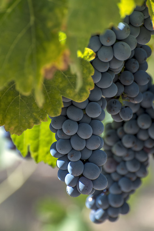
Valley View Winery grapes

@valleyviewwine

Good morning Ashland

sunrise ashland oregon

Ashland, Oregon sunrise

Today’s photo comes from a sunrise from last week. Today there is nothing but fog.

TBT

ellie ellie ellie smith lake

Smith Lake, California

Today’s random, throwback photo is from May of 2015. All three girls in this photo are named Ellie. What are the odds?

Grizzly Peak with snow above the fog

grizzly peak fog snow ashland oregon

Last week we were treated to a spectacular morning view. I headed out to the lower level of our roof to get this photo. I wanted to head up to the upper level for a better panorama of the sunrise with the fog filling the valley below, but the roof was covered in ice. I couldn’t move without falling so I had to settle for this.